Tutorial - Using Hunting Grounds Maps for Garmin Handhelds
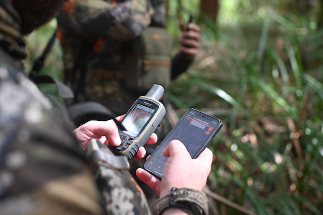
Hunting Grounds Victorian Crown Land Hunting Areas and Species Distribution maps are now available for Garmin Handheld GPS's that have a microSD card slot. A full list can be found here:
https://support.garmin.com/en-US/?faq=U8uZN9B2OM0AImFS8HFIxA
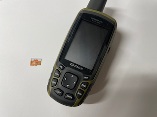
Installing the chip into your GPS
You should consult your manual for specific instructions on how to install a microSD card into your Garmin Handheld device. Some models may differ from the instructions below.
Step 1. Remove the back cover & remove the batteries

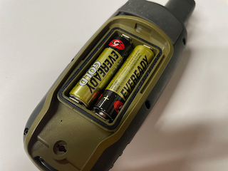
Making sure that your Garmin handheld is turned off, remove the back cover to expose the batteries. Once the back cover is removed, remove the batteries. You will see a small slot in which the microSD card will sit
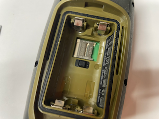
Step 2. Install the chip


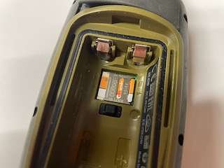
With the top of the unit facing away from you, using your fingernail, carefully pull the metal cage to the left to unlock the metal microSD card holder. Once it is unlocked, it should then fold upwards.
Once the cage is out of the way, carefully place the Hunting Grounds microSD card into the slot as shown.
Once the Hunting Grounds microSD card is located correctly, fold the cage back down and carefully pull it to the right to lock it into position.
Step 4. Replace the batteries, back cover, and turn on the unit
Now that the Hunting Grounds microSD card is installed, replace the batteries and the back cover, and you can now boot the unit.
Using Hunting Grounds Maps for Garmin Handhelds
Now that you have successfully installed the Hunting Grounds microSD card into your Garmin handheld, you will need to set up the maps to get the most out of it.
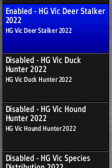
There are a total of 6 maps on your Hunting Grounds for Garmin Handheld chip. These are:
- HG Vic Deer Stalker
- A map showing permissable hunting areas for stalking Deer and pests
- HG Vic Duck Hunter
- A map showing permissable hunting areas for ducks
- HG Vic Hound Hunter
- A map showing permissable hunting areas for dogs and hounds
- HG Vic Species Distribution
- A map showing species distribution for:
- Fallow Deer
- Red Deer
- Sambar Deer
- Hog Deer
- Wild Goats
- Wild Pigs
- A map showing species distribution for:
- OpenTopoMap Australia Contours
- Countour lines to be used in conjunction with otm-australia
- otm-australia
- Up to date Topographical maps from the OpenTopoProject. Should be used as an alternative to the Garmin Basemap or Garmin TopoActive Basemap. The colour and patterns of the different Hunting Grounds maps were selected with this map in mind.
Note: By default, your Garmin will enable all of these maps the first time. This is not a good idea, as many of the maps will have a lot of crossover, and some will obscure others due to limitations in the way that Garmin devices present maps.
Disabling maps you do not want to use
It is a good idea to have only the specific maps that you want to use. For example, if you plan on hunting deer and pests by stalking, it is suggested that your disable the Duck and Hound.
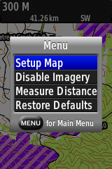
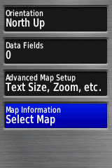
On your Garmin device, press the "Menu" button. Select "Setup Map" and press enter.
Scroll down to the map you want to disable, and press "Enter". When prompted, select "Disable" and press "Enter".
Using the maps
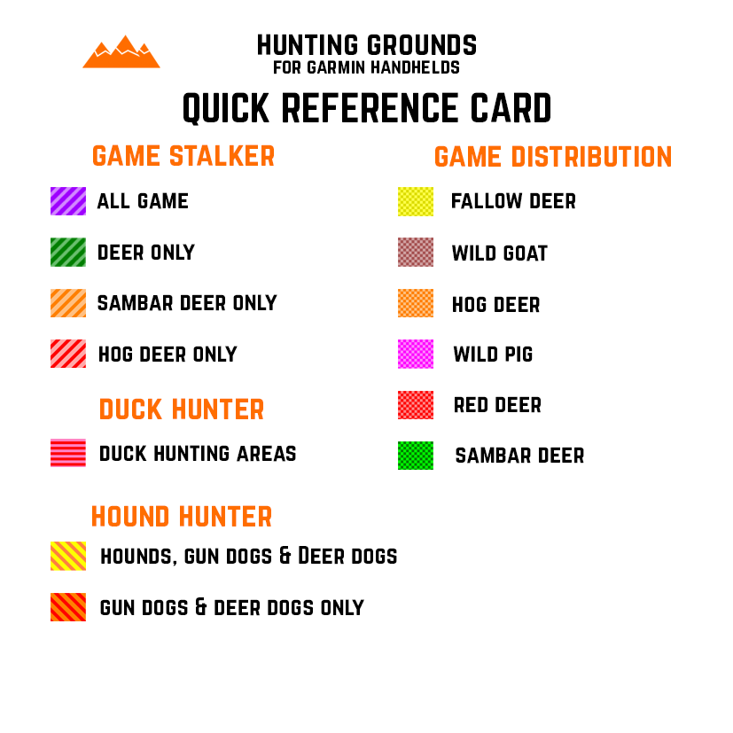
Your Hunting Grounds for Garmin GPS will have come with a quick reference card you can keep with you in order to quickly identify an area and what it means.
Each Map has different areas as indicated by the reference card, each with a unique pattern specific to the map, and a unique colour specific to the type of area that it is.
For instance, with the Deer Stalker layer enabled, areas that allow the stalking of Deer and Pest species such as Pigs and Goats is two different shades of purple, with diagonal lines.
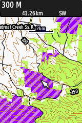
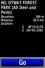
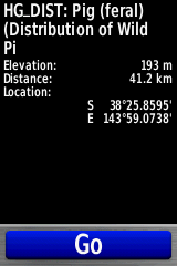
Each area also contains a limited amount of metadata which can be viewed using the Garmin GPS. To view the associated metadata for a given area, simply move the cursor over the area and press "Enter".
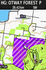
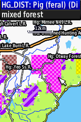
This will pop up a small display at the top of the screen that shows all available layer metadata for where the cursor is. If multiple layers under the cursor have associated metadata, you will need to select the appropriate entry you want to view by pressing the up or down button. Hunting Grounds layers are prefixed with "HG:" for maps and "HG_Dist:" for species distribution information.
You can view more information by pressing "Enter" again.
Happy Hunting!