Tutorial - Base Maps Overview

Hunting Grounds has a number of different base maps available for you to use, each providing a different perspective on the landscape on which you're hunting.
To change which base map you're using, tap the Base Map icon in the bottom menu, and then tap the base map you would like to use.
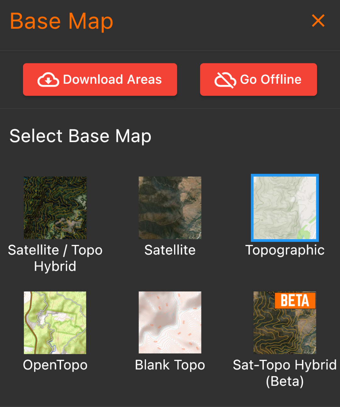
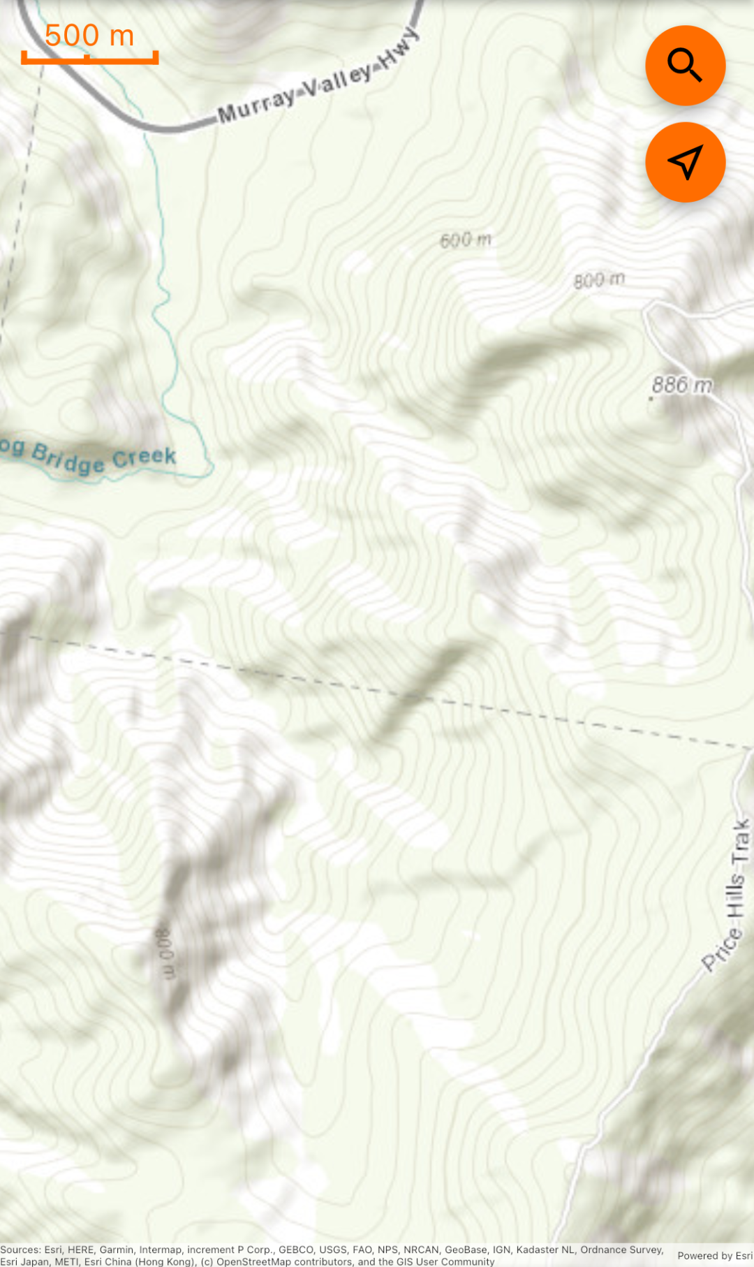
Topographic Base Map
Topographic base map is a simple and subtle basemap which provides a simple view of roads, land use, hill shading, and contours.
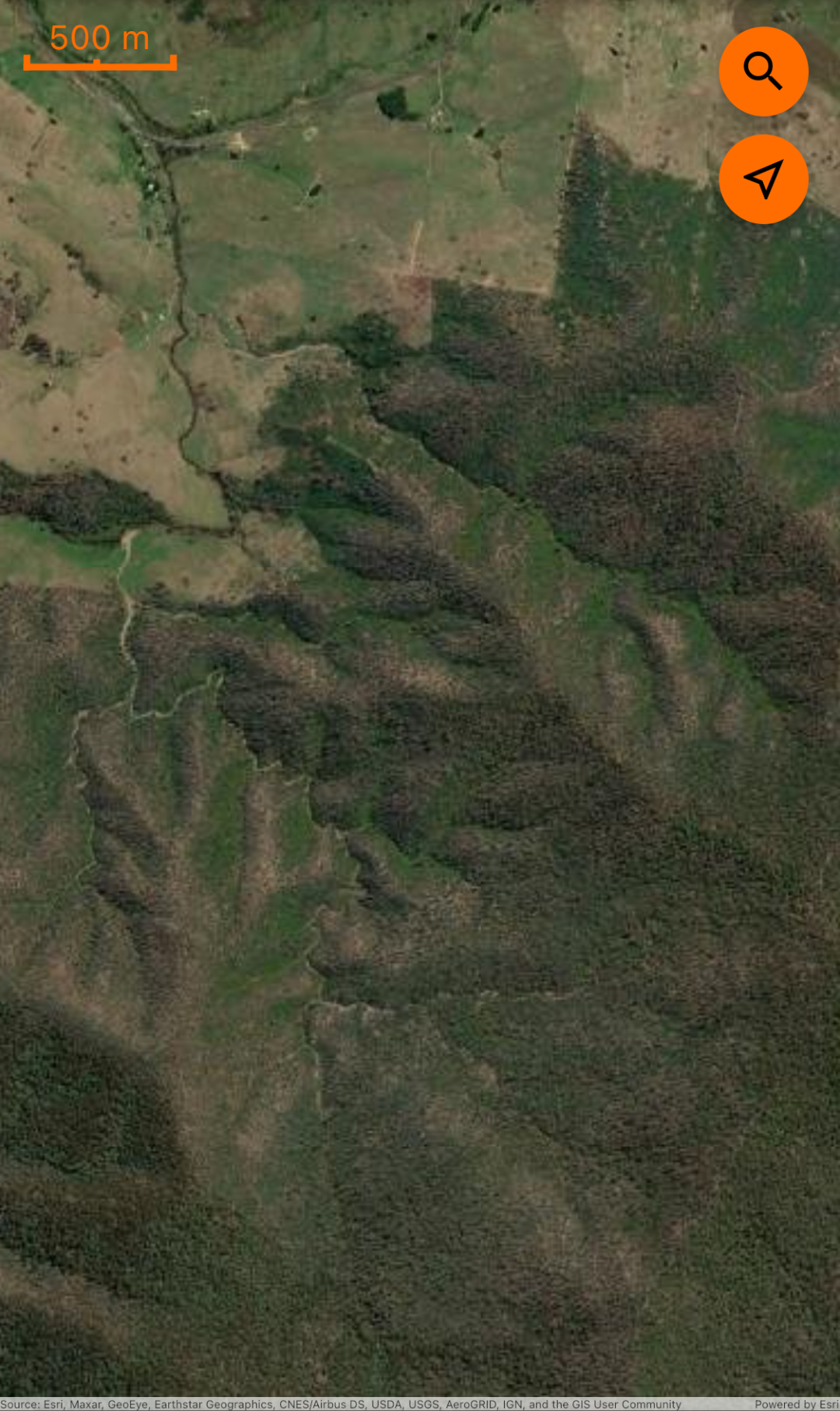
Satellite Base Map
Satellite base map is unmodified high resolution satellite imagery.
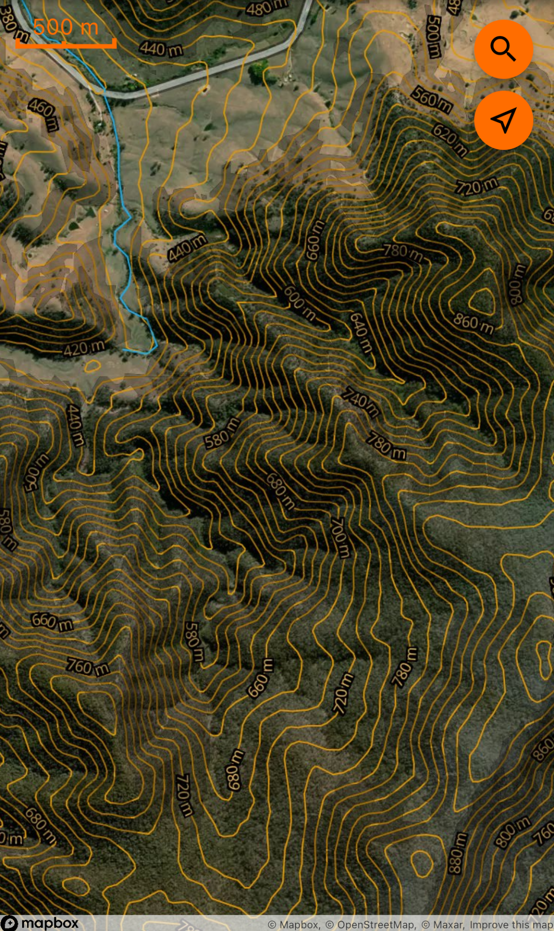
Satellite / Topo Hybrid Base Map
The Satellite / Topo Hybrid base map is just that - satellite imagery with topographical contour lines and contour labels overlayed on top. We have also overlayed roads, road names, waterways and waterway names, region labels and points of interest labels, and hill shading.
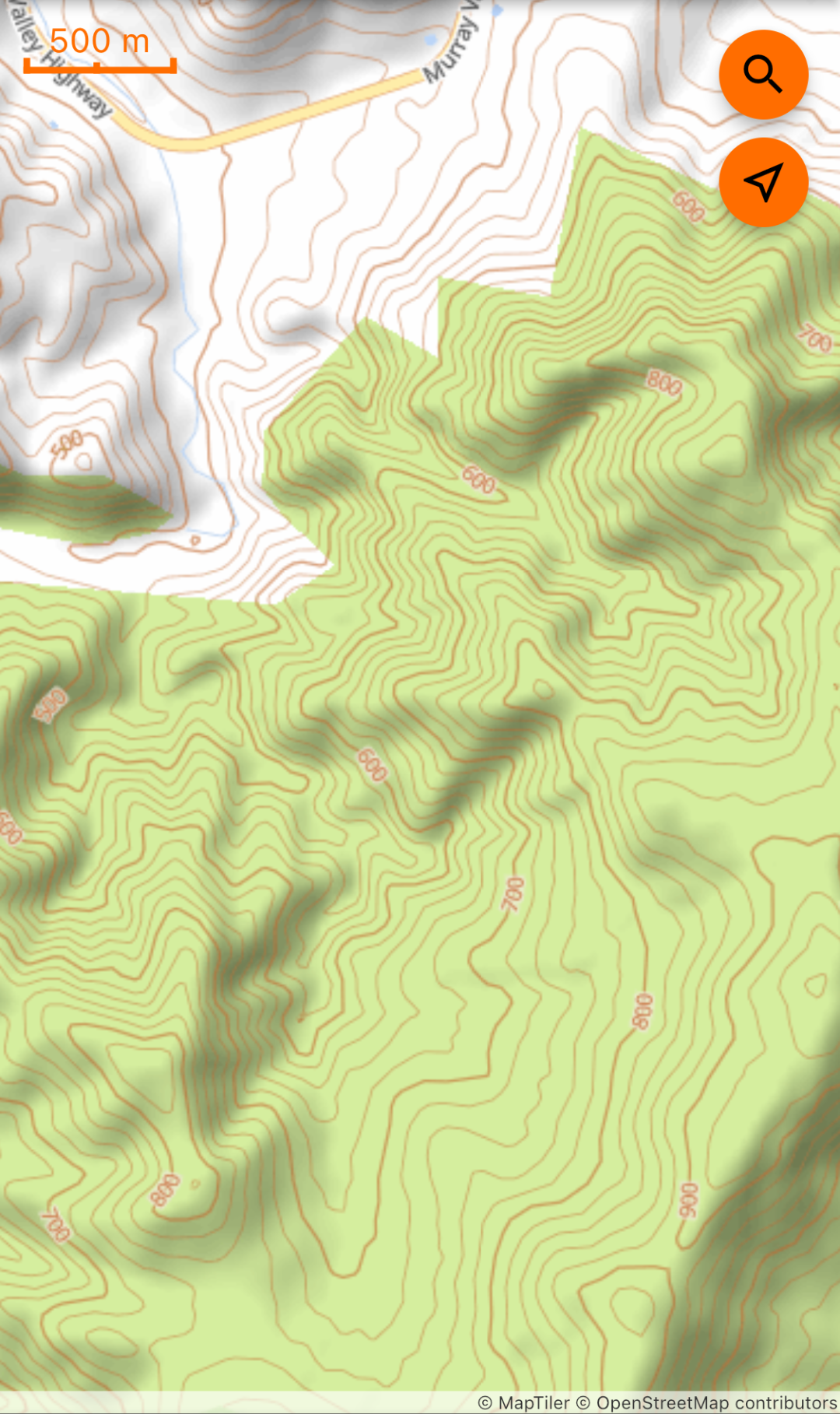
OpenTopo Base Map
OpenTopo base map is styled to mimic the maps available from the OpenTopoMaps project. This is a simple, clear, yet contrasting topographic map which itself has been styled to be reminiscent of the type of map you might expect to see on a handheld GPS.
Earlier incarnations of Hunting Grounds used the OpenTopo Maps map service directly, but due to performance concerns we moved to our own hosed service.
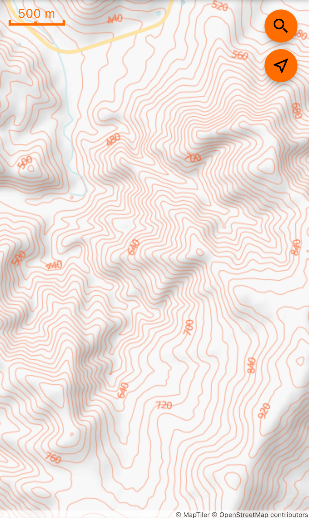
Blank Topo Base Map
Blank Topo base map is simply topographical contours on a white background. This is useful for getting a clear picture of the topography of a landscape without the distractions of other geographical features.